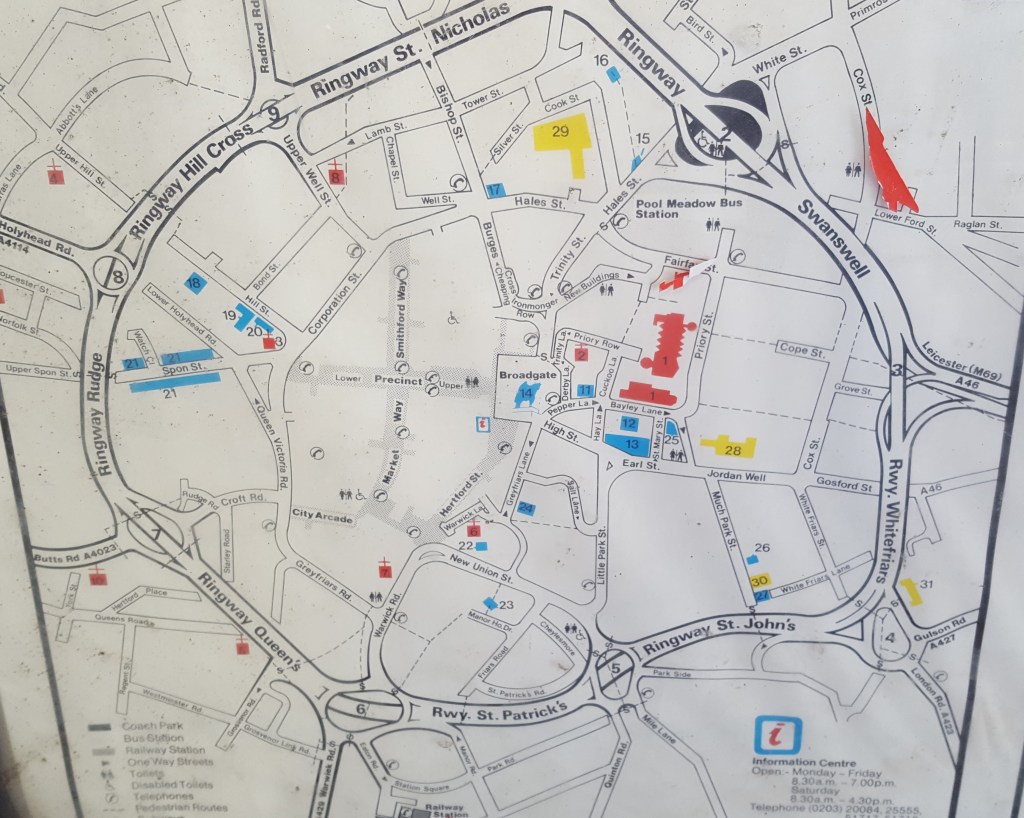
On my first visit to the new Salt Lane car park (see The View from Salt Lane) at the payment machine, there was this rather snazzy new map of the city centre. It’s great, nice and big, though it is very tourist focussed in that things like the University don’t seem to be on it. It does get a bit of shine on it, but that probably doesn’t matter if you are reading it because you’re blocking the light, it’s only an issue when you’re trying to take a photo of it for your blog and have to take the shot from an angle……
But most importantly, it is up to date. Or at least it was when it was put up in this ever-changing city.
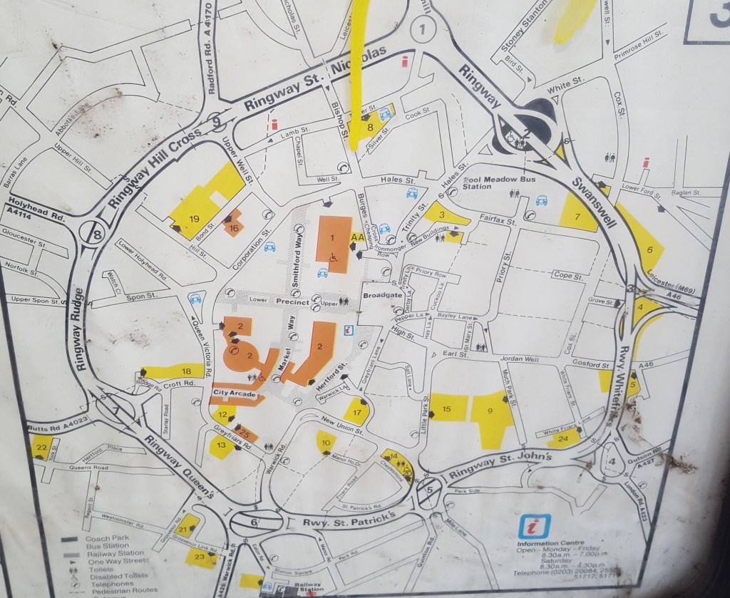
My normal parking haunt of The Barracks also has a map (actually three maps) that was up to date when it was put up. The problem is I reckon it was put up around 1987.

The obvious odd-job for the council is to replace it, but more than that, it absolutely needs preserving, and I would hope that once the Perspex has been replaced – as those tags may well be a work of art – that there is a wall waiting for it at the Herbert, or indeed anywhere else. If I ran a pub, I’d have it on my wall!
Because what has happened here is that the failure to replace this map for over thirty years, for whatever reason, has created a genuine historical artifact: a snapshot of what Coventry was like, or at least what was considered to be of interest to visitors in the 1980s. If it had been replaced when it became out of date, it would have long since turned to ash in the London Road incinerator.
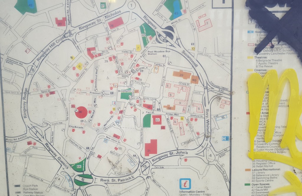
Like the model of Coventry in 1509, this gives a snapshot of what the city was like at a specific point in time, and whilst you can look at the model and see the few buildings still standing 500 years later, it’s genuinely amazing to see just how much has changed in 30 odd years.
I’m obviously guessing at 1987, but there is one give away for the time window of when it was made, and that is “Coventry Lanchester Polytechnic”. The Lanch was Lanchester Polytechnic until 1987, but did not become a university, Coventry University, until 1992. It had been decided that as The Lanch had become more of a national player, a name change was needed as people though it must be somewhere between Lancaster and Manchester. But between 1987 and 1992 there were two names, because while the name by 1991 was certainly Coventry Polytechnic, for a while there was an official transitional name of “Coventry (Lanchester) Polytechnic”, and that – without the brackets – is what is on the map.

Of course there may well be something on the map that suggests a different time and whoever labelled the uni just got it wrong,
But anyway, this map needs taking down and replacing, It’s at the Hertford Street entrance to the Barracks, i.e. it’s the nearest public map of Coventry to the City of Culture shop!. And it needs preserving. I’ll have it if no-one else wants it. It can’t simply be chucked out, especially when all it needs is a wall to hang on.